Cotwall End Local Nature Reserve
Matt’s maps
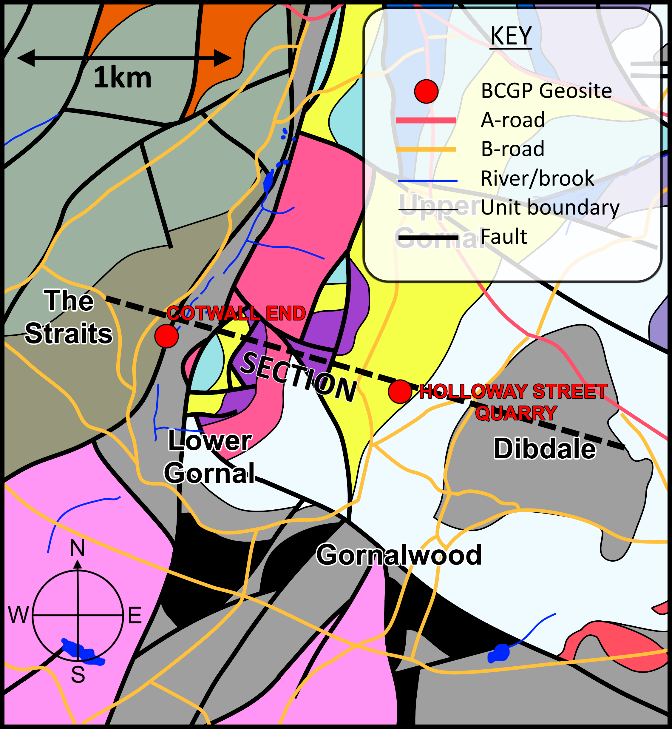 Keen-eyed readers may have experienced a sense of déjà vu scrolling through the images as I am re-using the same map as Holloway Street, Lower Gornal.
As a nature reserve, Cotwall End is a beautiful set of well-maintained footpaths meandering through a wooded valley. At its northern end the reserve consists of open fields, making the park a charming and varied environment. Both historically and geologically, Cotwall End is a place of contrasts – once hosting both a stately home and major collieries. Geologically, it is a complex smattering of rock types and faults spanning through more than 100 million years of geological history.
Faulting is responsible for the overall landscape of this area. Two major faults – the regionally important Western Boundary fault, and the locally significant Shut End fault converge here, as do numerous other smaller faults.
On the northeastern boundary of the reserve is a natural spring known as the ‘Sugarwell’, which emerges from a fault plane dividing the ~420 million year old Silurian Raglan Mudstone and the (comparably youthful) ~310 million year old Coal Measures. Instant disappointment greets readers of the official leaflet guide for Cotwall End. We learn that that this spring was once renowned for its sweet flavour, but also that Dudley Council strongly advise you do not drink it. If any readers have bravely disregarded this advice then I’d be keen to hear from them.

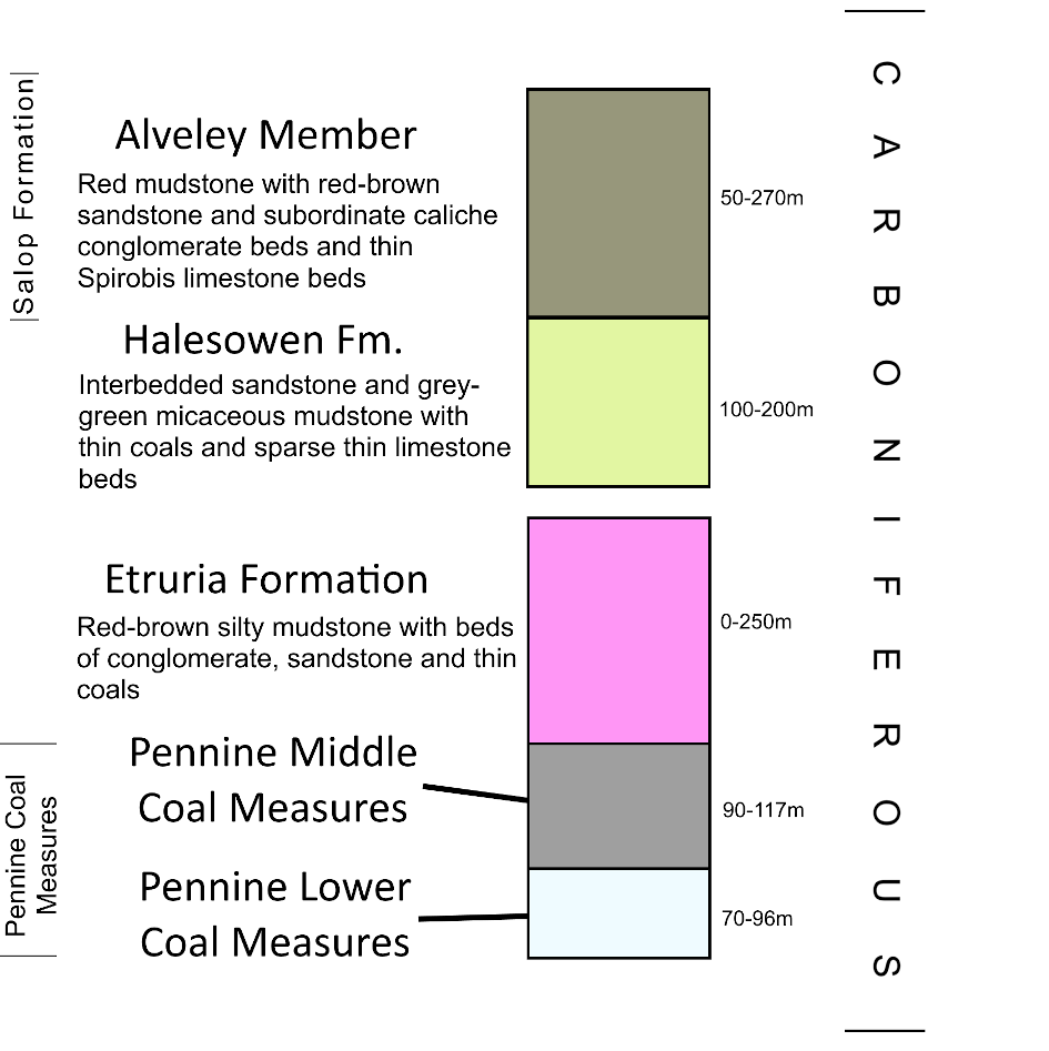
The Sugarwell and other natural springs emerge from the faulted valley walls. They converge to form ‘Bob’s Brook’, the small stream that trickles through the wooded valley. It gains its name from the shallow ‘bob holes’ dug throughout the valley. These were shallow vertical shafts that attempted to find coal seams lying just below the ground level of the valley. Bob holes worked shallow depths and precariously extracted rock in a bell-shape until all useful minerals had been removed. Rocks of the Carboniferous Coal Measures occupy the whole of the low ground at Cotwall End, and the most productive and economically important coal seams were easy to access here.
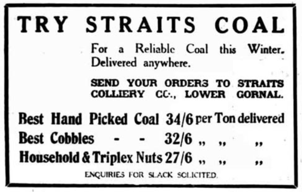
A 1931 newspaper advert for coal from Straits Colliery, which operated in Cotwall End Valley.
Cotwall End rises steeply on its eastern boundary as you move towards the Silurian rocks in Lower Gornal that I discussed in the last newsletter. The Shut End fault lifts these older rocks stratigraphically above their Carboniferous neighbours. It exposes a fascinating set of rock units at Turner’s Hill.
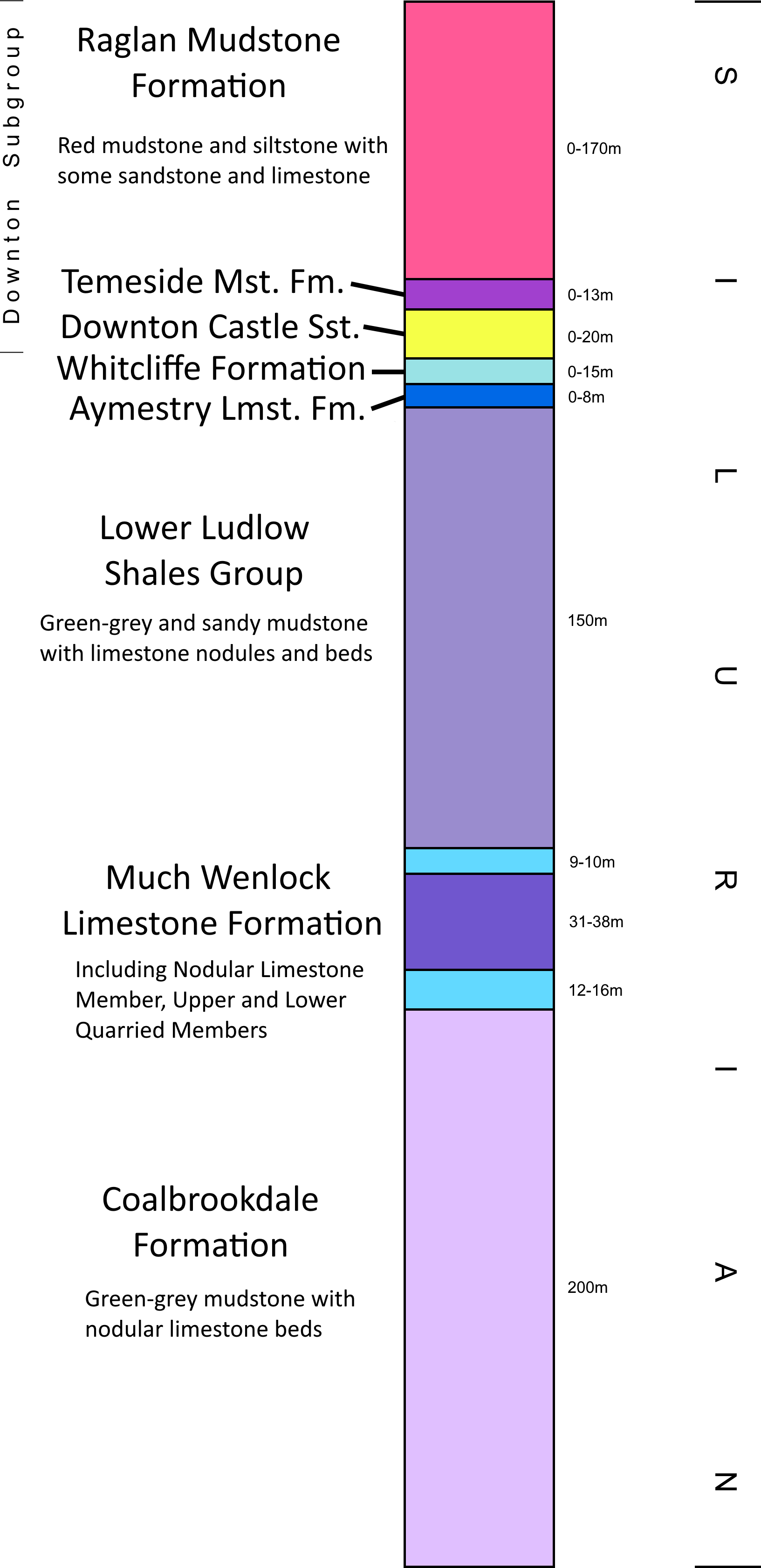
The relationship between the geology at Turner’s Hill, Cotwall End Valley and Lower Gornal Quarries was a source of mystery to local geologists of the early 20th century. In both Cotwall End Valley and Lower Gornal, people had been exploiting the geology beneath their feet to make a living. In contrast, Turner’s Hill was never quarried at scale, as can be seen by the survival of its woodland from 1881 all the way to the present day. A 1951 research paper by H. W. Ball set about resolving the local relationships of the major exposures around Gornal.

Stratigraphic column comparison of Turner’s Hill (Cotwall End) and Lower Gornal, modified from figure in Ball (1951).
Note that only a few rock unit names (left column) have survived BGS nomenclature changes over the past 70 years.
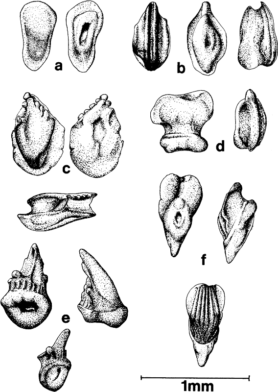
Sketches of six fish scales from the Ludlow Bone Bed, image taken from Turner (1973). No complete skeletons have been recovered from the Ludlow Bone Bed, but individual scales (denticles) are extremely common.
Gornal Sandstone also outcrops in Cotwall End at Turner’s Hill, proving that these units too must be of Silurian age. Turner’s Hill also hosts Silurian rocks slightly younger than the Gornal Sandstone, and some of these are particularly fascinating to those interested in the history of life.
At Turner’s Hill we find an inconspicuous dark layer, only a few inches thick. This is a compact unit that is absolutely packed with fragmented fossil fish remains. Its name is the Ludlow Bone Bed, and its age was recently established using uranium and lead isotopes as 425 million years old. Very few fish are known from rocks older than the Ludlow Bone Bed, and the sudden increase in the abundance and diversity of fish swimming the Silurian seas at the time likely represents a substantial shift in either the local environment, or the global ecosystem. The Ludlow Bone Bed is also well exposed in other local Geosites, and will be the subject of future articles.
Cotwall End Valley encapsulates much of what makes the Black Country Geopark great – only a few square miles of land that are disproportionately packed with historical and geological richness. A story is made up of countless words combined in the right way. Cotwall End Valley demonstrates that even the most inconspicuous outcrop, when viewed from a new perspective, can shift our understanding of the Earth beneath our feet.
This article was written for BCGS Newsletter 271 by Matthew Sutton.
Reference and Further Reading
Lower Gornal history website page on collieries in Cotwall End Valley: http://www.lowergornal.co.uk/i_mining_dingle.htm
Excellent website for finding old Ordnance Survey Maps: https://www.oldmapsonline.org/
Ball, H.W., 1951. The Silurian and Devonian rocks of Turner’s Hill and Gornal, South Staffordshire. Proceedings of the Geologists’ Association, 62(4), pp.225-IN1.
Turner, Susan. ‘Siluro-Devonian thelodonts from the Welsh borderland.’ Journal of the Geological Society 129, no. 6 (1973): 557-582.
Black Country Geopark
Cotwall End Valley is one of the Black Country Geopark’s Geosites.