Geoconservation Day, Saturday 1 October 2016
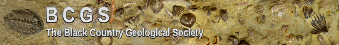
Brewins Cutting, Saltwells LNR
Brewins Cutting, before clearance…
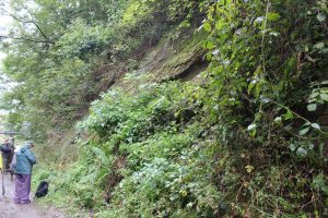
This exposure shows two markedly inclined beds of sedimentary strata dipping towards the east. These include Middle Carboniferous Pennine Lower Coal Measures (formerly Westphalian C) overlying Late Silurian (Pridoli) strata. The Carboniferous strata comprise reddish-brown and greenish-grey mudstones/shales including coal pockets and sandstone, with a layer of clasts within a finer matrix towards the base. The Silurian strata comprise greenish-brown mudstones belonging to the Raglan Mudstone Group (formerly the Red Downtownian), which in turn overlie the Temeside Mudstone Formation (formerly the Temeside Shales). The contact between the Carboniferous and Silurian strata represents 100 million years of missing geological history, including Devonian and Lower Carboniferous strata. The Carboniferous and Silurian beds dip at slightly different angles, making this contact an angular disconformity.
The contact between these two strata represents a major mountain building period, the Caledonian Orogeny, which was a result of the Avalonia/Baltica landmass colliding with Laurentia. This event caused the closing of the Iapetus Ocean and the formation of the Caledonian mountain chain. The chain formed part of a landmass, known as the Wales-Brabant Massif that stretched across Wales and central/southern England. It was on the northern edge of this landmass that the Black Country sat in mid to late Carboniferous times.
…and after clearance