Portway Hill, Blue Rock Quarries
Stratigraphy and Status
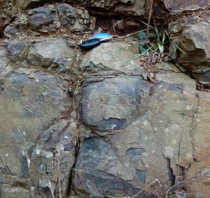
Spheroidal weathering, Blue Rock Quarry.
Photo by Julie Schroder
These basalts and dolerites were intruded in a hot ( >1000°C) molten state into strata of the Coal Measures and Etruria Marls late in the Carboniferous Period (in Westphalian D times) as a result of major earth movements of the Hercynian (also known as Variscan) mountain building episode that were occurring at this time. The magmas slowly cooled at depth and formed the hard crystalline rock that is locally called today the ‘Rowley Rag’. As the molten mass cooled and solidified it contracted and formed the cracks that create the columns that we see today. There is open access to the exposures from footpaths leading from Bluestone Walk and associated estate roads.
Matt’s Maps

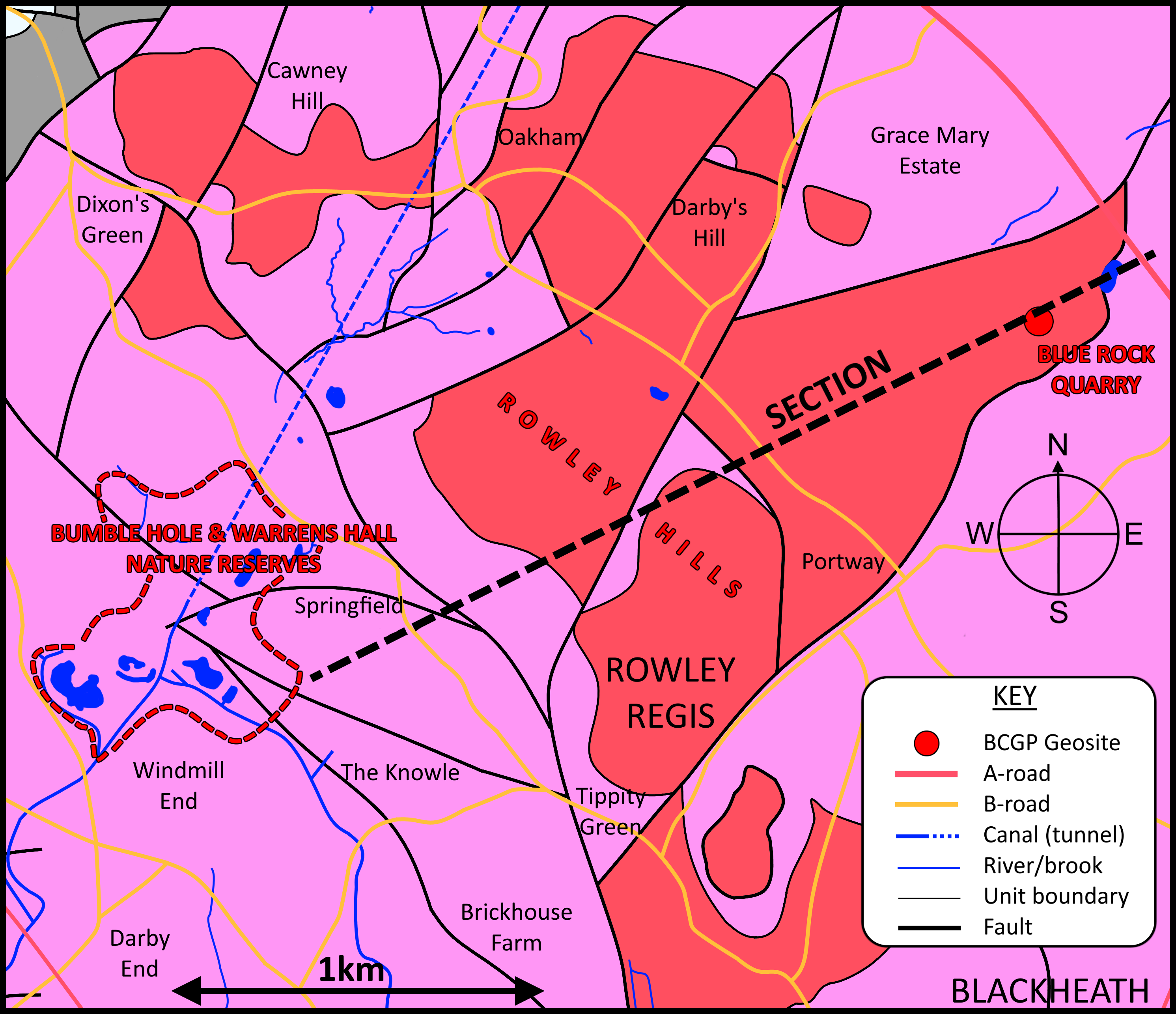

See BCGS Newsletter 269 for Matt’s full article.
Black Country Geopark
Blue Rock Quarry is one of the Black Country Geopark’s Geosites.
Find your way
Hover over a star to see a label.